| COLLECTION | Maps |
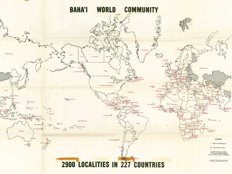
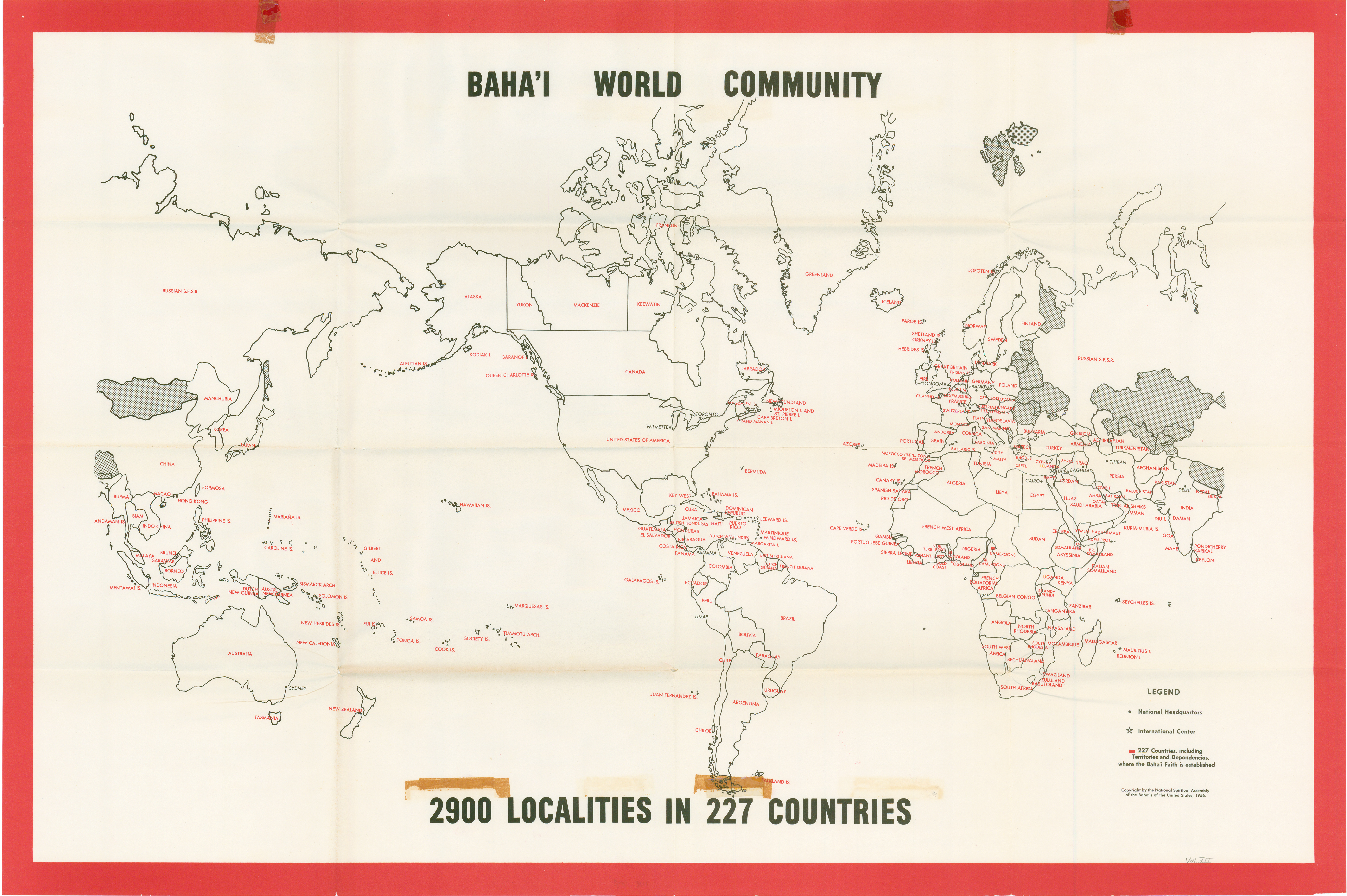
| TITLE | Localities where Bahá'ís live (world, 1956): simplified map |
| CONTRIB 1 | National Spiritual Assembly of the Bahá'ís of the United States, comp. |
| DATE_THIS | 1956 |
| VOLUME | Vol. 12 (April 1950-1954) |
| TITLE_PARENT | Bahá'í World |
| PUB_THIS | Bahá'í Publishing Trust |
| CITY_THIS | Wilmette, IL |
| NOTES |
Scanned by Kinko's for John Conkling.
See also Index to Maps and charts in Bahá'í World volumes. |
| TAGS | - Worldwide; Maps; Statistics |
| |
| CONTENT |
| Click on one of the links below to see this image in different sizes. It was originally scanned at 600ppi and saved as uncompressed TIF, which I converted to JPG. The smaller versions have been lightly edited to improve contrast. To see the uncropped, unedited JPG file, click on the "Full" link below. Note: the Full image is huge, please try the smaller sizes first. The "Big" image should be large enough for printing. Original map measures 58 cm high x 87 cm wide. |
preview image:
 |
|
| VIEWS | 6851 views since 2010-09-11 (last edit UTC) |
| PERMISSION | open copyright |
| LANG THIS | English |