Bahai Library Online

>   Maps
Notes:
Scanned by Kinko's for John Conkling.

See also Index to Maps and charts in Bahá'í World volumes.


Bahá'í community of the United States (1950)

published in Bahá'í World Vol. 11 (1946-1950)

Wilmette, IL: Bahá'í Publishing Committee, 1952

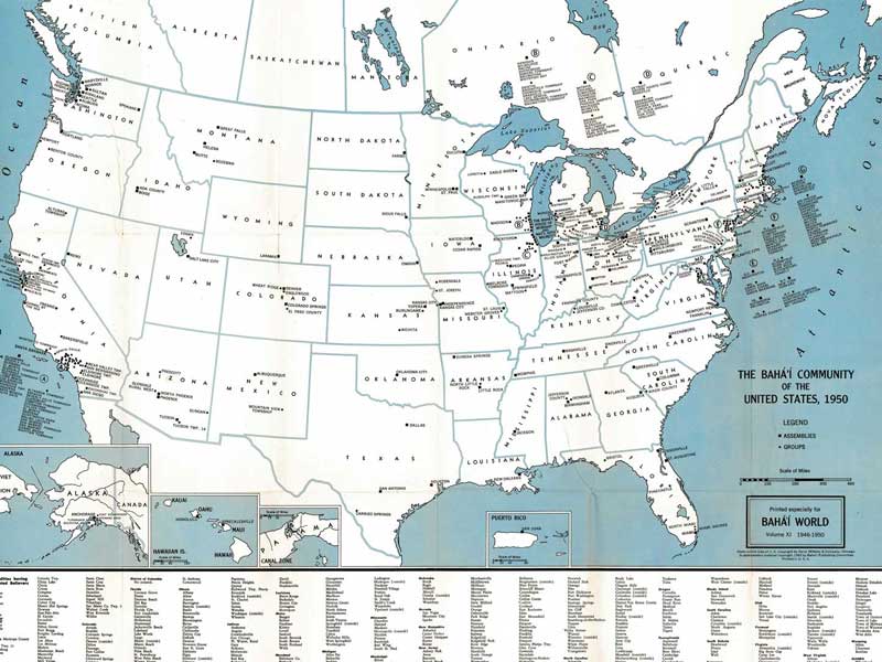
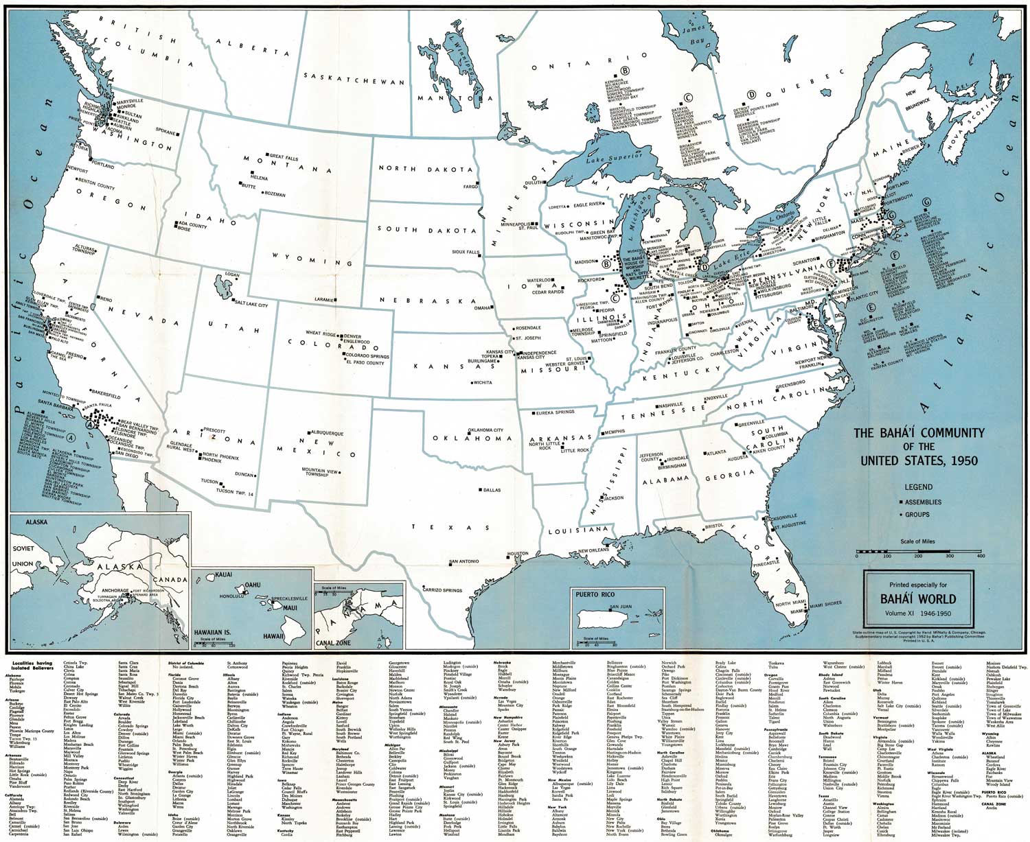
Click on one of the links below to see this image in different sizes. It was originally scanned at 600ppi and saved as uncompressed TIF, which I converted to JPG. The smaller versions have been lightly edited to improve contrast. To see the uncropped, unedited JPG file, click on the "Full" link below. Note: the Full image is huge, please try the smaller sizes first. The "Big" image should be large enough for printing. Original map measures 63.5 cm high x 77 cm wide.
Small1500x1227 px262KB bw11_map1_united_states_1950_small.jpg
Medium3000x2465 px867KB bw11_map1_united_states_1950_med.jpg
Big8000x6572 px5MB bw11_map1_united_states_1950_big.jpg
Full18062x14838 px44MB bw11_map1_united_states_1950_full.jpg

preview image:

VIEWS20552 views since 2010-09-11 (last edit UTC)
LANG THISEnglish
PERMISSION   open copyright
Home Site Map Links Tags Chronology About Contact RSS